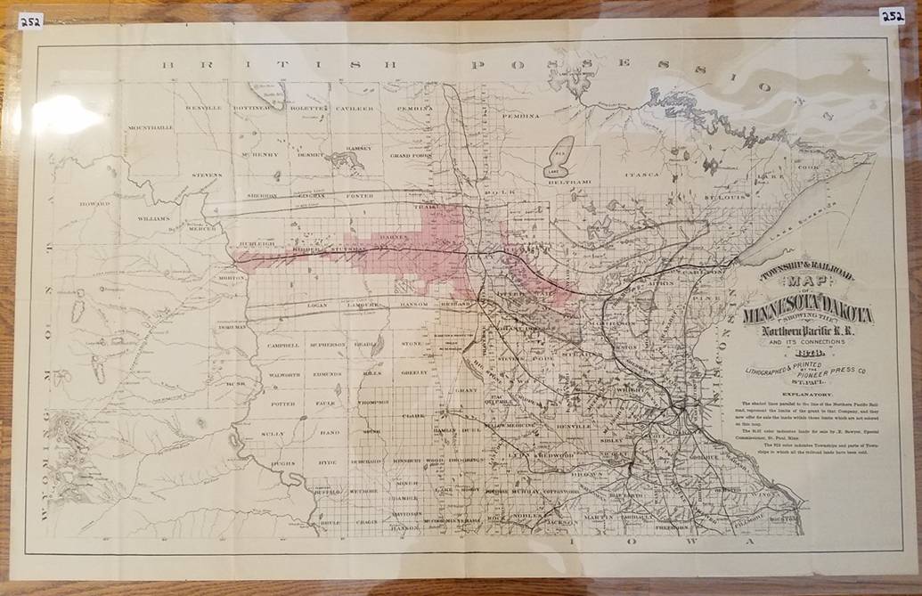
252. (-----, 1878). “Township & Railroad Map of Minnesota and Dakotas, Showing the Northern Pacific R.R. and Its Connections” (St. Paul, 1878). Lithographed map, 44 x 74cm, plus margins. Lands for sale along RR in red and blue; shows towns, waterways, RRs, Indian reservations; verso is printed text, statistics in 16 panels. Condition: encapsulated; fold lines; good.