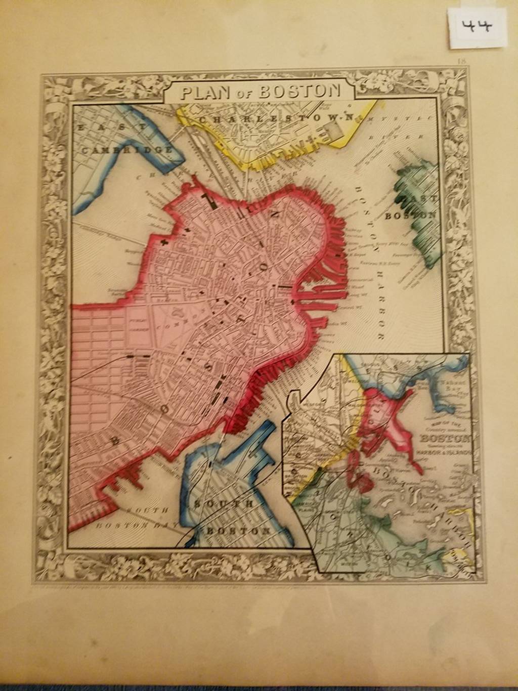
44. (Boston, 1860). S. Augustus Mitchell, Plan of Boston (Philadelphia, 1860). Lithographed map, 24 x 20cm, plus wide margins. Atlas map: decorative border; shows streets, RRs, parks, wharves, etc. Inset “Map of the Country Around Boston, Showing also Its Harbor & Islands.” Condition: encapsulated; very good.